


Printing method | Giclée
Size | A3 (297x420mm / 11.69x16.53in)
Limited Edition | No
Paper | Hahnemühle German Etching 310 gsm
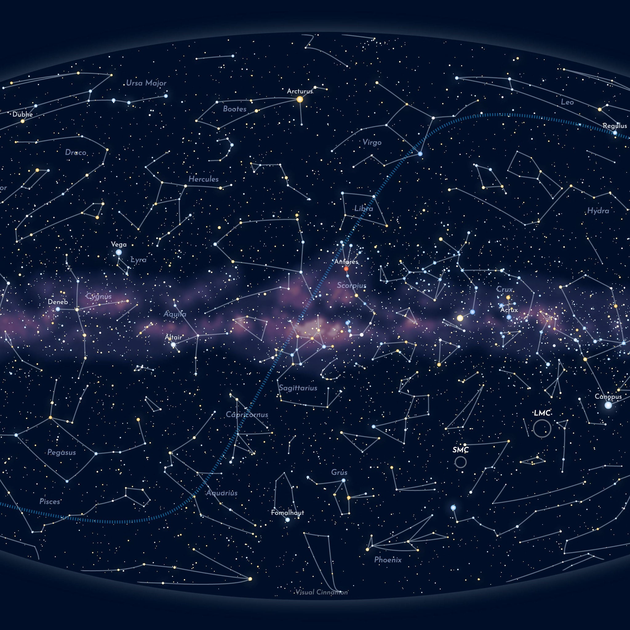
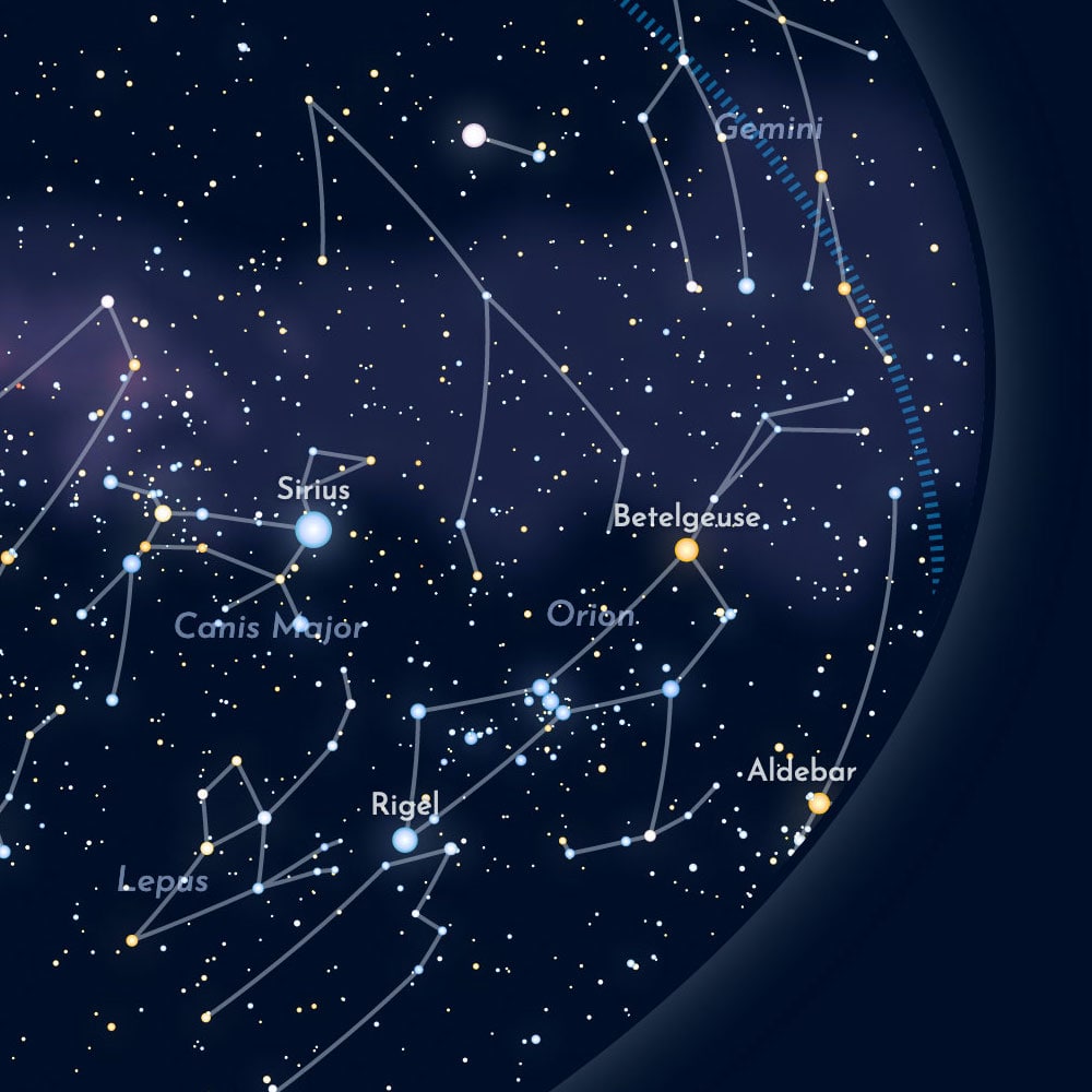
A map of the sky with all the stars that are visible to the naked eye (under the most ideal circumstances), and the 88 Western constellations. This map uses the Aitoff projection and is oriented such that the plane of the Milky Way runs horizontally through the center of the map. Towards the upper-left is the Pole star (and majority of the Northern Hemisphere), while the Southern Hemisphere is found mostly in the lower-right section of the map.
Being officially a graduated astronomer, I have a big love for all things related to astronomy. Especially if this is combined with data visualization. Over the years I've made several visualizations related to the stars. For this poster, I've combined several of those projects to finally create a true map of the night sky.
This sky map tries to convey the reality of our sky by coloring the stars according to how they actually appear to us (using their temperatures), sizing the stars to make the brighter ones bigger and adding the Milky Way streaks in the background. The blue dashed line represents the ecliptic, the imaginary path that the Sun follows over the course of a year.
Printed with archival ink on high-quality Hahnemühle German Etching fine art paper (310 gsm) by theprintspace. This heavyweight paper has a strong texture on which deep colors feel rich and high in contrast.
Small note | The final image shows a real life photo of version 1 of the Sky Map, which uses the Stereographic projection.